|

Click on book cover to order!
Book Excerpt Below |
The Best In
Tent Camping
Tennessee

ISBN: 0897326083
This tent camping guide offers
the 50 best tent camping destinations in Tennessee, from the
Smoky Mountains to the mighty Mississippi, from the Land Between
The Lakes to the raging Ocoee River, from the cliffs of the Big
South Fork to the winding roads of the Natchez Trace.
This book was researched over several years.
Learning about Tennessee was easy for the Volunteer State
native, but even so Johnny found new places to visit and add to
this book. |
Book Overview
Tennessee is one of
the oldest states west of the Appalachian Mountains. Settled by men
such as William Blount and James Winchester, the Volunteer State is
steeped in American history, from the settler’s gathering to form a
state at Sycamore Shoals to Meriwether Lewis untimely death on the
Natchez Trace to the Civil War’s Fort Pillow. Pioneers traveled on
rough overland trails and along rivers, used for passage through the
vast forests that thrived in their interiors. These high, rich
mountains, including the Appalachians and the Cumberland Plateau,
still form a rampart to settlement and now offer preserved
destinations. Farther west are the floodplains and shores of the
Cumberland, Tennessee rivers, with their own unique forests and
animal life. The Mississippi River forms the state’s western border
and has it lowest elevations.
Today tent campers
can enjoy these parcels, each pieces of distinct regions of
Tennessee. In West Tennessee, you can explore the surprisingly
hilly terrain of Big Hill Pond, on the Mississippi border, or the
bluffs and riverine forests of Meeman-Shelby State Park. Middle
Tennessee is the land of unique cedar glades where unusual plants
and animals still thrive and where the water falls from the western
Cumberland Plateau. This is also lake country, where reservoirs
built to prevent disastrous flooding now are recreation
destinations, such as Center Hill and Percy Priest Lake. East
Tennessee has the highest of the high, including the crest of the
Appalachians, where elevations in the Smoky Mountains exceed 6,000
feet. The campgrounds in the Cumberland Mountains offer rock bluffs
overlooking gorges cut by water and time, and unique arches and
caves.
Dennis Cove campground
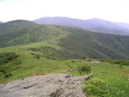
Appalachian Trail near Dennis Cove
| Campsite Name |
Dennis Cove |
| Campsite City |
Hampton |
| Beauty Rating |
4 |
| Privacy Rating |
3 |
| Spaciousness Rating |
4 |
| Quiet Rating |
4 |
| Security Rating |
3 |
| Cleanliness Rating |
3 |
| Address |
4400 Unicoi Drive, Unicoi, TN
37692 |
| Operated by |
U.S. Forest Service |
| Information |
(423) 638-4109; www.fs.fed.us/r8/cherokee |
| Open |
May through September |
| Individual sites |
15 |
| Each site has |
Picnic table, fire ring, tent pad, lantern
post |
| Site assignment |
First come, first served, no reservation |
| Registration |
Self-registration on site |
| Facilities |
Water spigot, flush toilet |
| Parking |
At campsites only |
| Fee |
$10 per night |
| Elevation |
2,650 feet |
| Restrictions - Pets |
On leash only |
| Restrictions - Fires |
In fire rings only |
| Restrictions - Alcoholic beverages |
At campsites only |
| Restrictions - Vehicles |
Two vehicles per site |
| Restrictions - Other |
14-day stay limit |
| Summary Quote |
Laurel Fork Valley is your cool headquarters
for this getaway. |
| To get there |
From Hampton drive north on US 321 for
0.8 mile. Watch carefully for the sign with the picture of a
tent on it on the road’s right. Turn right there. It’s the
unmarked Dennis Cove Road. Climb away from Hampton for 3.9
twisting, turning miles. Dennis Cove Campground will be on
your right.
|
Camp here and enjoy the delightful
national forest that surrounds the fine campground. It can be busy
on weekends, but no busier than other national forest campgrounds.
There are fishing and hiking opportunities at Dennis Cove that will
help you recoup some of the investment you made in these public
lands. They are, after all, your lands to enjoy. The intimate
campground is set in a small flat alongside Laurel Fork. A steep,
sloped ridge and thickly wooded creek hem in the campground. There
is no mistake, you are deep in the bosom of the Southern
Appalachians. The bellwether of eastern mountain beauty, the
Appalachian Trail, runs near here and is easily accessed from the
campground itself.
As you pull into the campground, a
small, grassy glade provides sunlight in this deeply forested cove.
This area was timbered in the 1920s and has recovered nicely. A
teardrop-shaped loop holds 13 of the 16 campsites. The first two
sites abut the glade. Two other sites lie inside the loop, which has
a grassy area of its own. The next three sites on the outside of the
loop are heavily shaded by hemlock trees. Then the loop swings
around to the four most popular sites, situated alongside gurgling
Laurel Fork. The understory is denser here, owing to the abundance
of rhododendron, which thrives in the cool, moist environs of
Appalachian streams. Two more sites are widely spaced on the outside
of the gravel road as it completes the loop. Hardwoods mix with a
few white pines in these flat sites.
Three other sites lie across the
gravel road leading to the loop. These sites, large by any
campground standard, are carved out of the steep hill bordering
Dennis Cove. Each site is separated by woodland. If it has rained
lately, as it often does here, these spots are your best bet for a
dry campsite.
Three water spigots are evenly
dispersed about the loop. Just turn the handle and the water’s
yours. A small comfort station, with one flush toilet for each sex,
is 100 feet off the loop away from the campground entrance. Moss
growing on the stones scattered about the area is evidence that this
campground has been around a long time; however, it is revamped
periodically. Before my visit, the loop road was freshly graveled
and the fire rings were rebuilt. Explore your surroundings after
you’ve set up camp. The waterfall enthusiast has three destinations
within walking distance. Walk back toward Hampton half a mile and
soon you’ll see a creek coming in on the left. Follow the old,
0.8-mile trail, often tread by Dennis Cove campers, up to Coon Den
Falls. If you continue beyond the falls, you can access the AT. Turn
left and climb along White Rocks Mountain to Moreland Gap trail
shelter. Back down a little farther on Forest Road 50 toward
Hampton you’ll find more Appalachian Trail. Leave directly from FS
50 and follow the old railroad grade into the Laurel Fork Gorge and
the Pond Mountain Wilderness. Rock outcrops and a riverine
environment lead you to Laurel Falls. If you keep going, you’ll end
up in Maine. Forest Trail #39 leaves from the campground and
follows Laurel Fork into the high country. This trail crosses Laurel
Fork several times as it leads to Laurel Falls upstream. This trail
is popular with fishermen, who match wits with the secretive brown
trout that inhabit Laurel Fork. The Lacy Trap Trail, which leaves
Laurel Fork in a field, leads to the AT and offers a great loop hike
I have enjoyed. The recreational opportunities available near Dennis
Cove are limited only by your desire. The 6,000-acre Pond Mountain
Wilderness is close by, as is mountain-rimmed Watauga Lake. So find
some time and head on over.
|