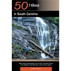
Book Overview
This book details 50
hikes that take place in South Carolina, from Opossum Falls near the
Georgia state line to Huntington Beach State Park on the Atlantic
Ocean and throughout the state between. Specific emphasis was placed
on the most scenic destinations and unique places that make South
Carolina so special, places like the Chattooga River, Peachtree Rock
and Hunting Island. South Carolina has two long trails, the
Foothills Trail and the Palmetto Trail. The Foothills Trail
traverses the mountain corner of the state, while the Palmetto Trail
is
 slated
to head from the South Appalachians, through the Midlands to the
Atlantic Ocean. Many hikes in this book take place on both the
Foothills Trail and the Palmetto Trail. South Carolina offers three
distinct regions in which to trek, the Upstate, Midlands and
Lowcountry. Hikes covering all three areas, of assorted lengths and
difficulties are included, and add to the variety of experiences. slated
to head from the South Appalachians, through the Midlands to the
Atlantic Ocean. Many hikes in this book take place on both the
Foothills Trail and the Palmetto Trail. South Carolina offers three
distinct regions in which to trek, the Upstate, Midlands and
Lowcountry. Hikes covering all three areas, of assorted lengths and
difficulties are included, and add to the variety of experiences.
This book will help you make every step count, whether you are
leading the family on a brief day hike or undertaking a challenging
backpack into the reaches. With your precious time and the knowledge
imparted to you, your outdoor experience will be realized to its
fullest.
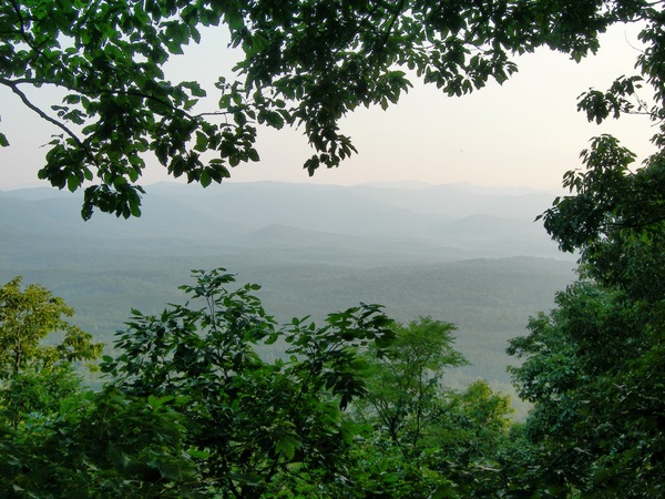
View from Tamassee Knob in the Sumter National Forest
Hike Excerpt
Hunting Island State Park Loop
Total Distance: 3.1 miles
Hiking Time: 2:00
Vertical Rise: 10 feet
Rating: Easy
Maps: USGS 7.5’ Fripp Inlet,
Hunting Island State Park Trails
Hunting Island State
Park is South Carolina’s largest island park and is not only a great
beach destination, but also offers good hiking trails, a quality
campground, cabins and one of the most beautiful lighthouses in the
Southeast. The loop hike described offers attractive coastal scenery
as it enters a dense forest palms, pines, and live oaks, to then
travel along a tidal lagoon just on the backside of the Atlantic
Ocean. The estuary is very attractive. Near the end of the lagoon,
the trail curves back inland, undulating through ancient wooded
dunes on old fire roads in a deep dark forest where furtive deer
bound away through thickets. This inland forest is markedly
different than nearly every other hiking destination in this book,
so enjoy it before you complete your loop. The mosquitoes can be
troublesome during summer on this trail, as will heat. The park is
busy during summer with beach goers, and if you choose to visit
then, bring bug repellent and plan your trek for early in the
morning. Late fall through spring is the preferable time to enjoy
this hike, however. A side trip to the Hunting Island Lighthouse is
a must if you come here. One more thing – parts of the movie
“Forrest Gump” were filmed in the vicinity of the trail.
How to Get There
From
Exit 33 on I-95, take US 21 south for 42 miles, through the town of
Beaufort and staying with US 21 to Hunting Island. Pass the left
turn to Hunting Island State Park campground and continue on to the
left turn into the main park. Keep beyond the side road to the
visitor center to reach an intersection. North Beach Road leaves
left. Stay forward at this intersection, not on North Beach Road,
then stay right, passing beach accesses to reach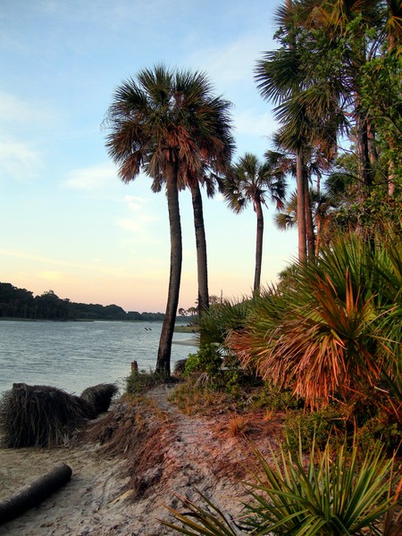 Parking Area J. The trail starts at the road cut in the middle of
Parking Area J leading away from the Atlantic Ocean and the tidal
lagoon. There is a park entrance fee.
Parking Area J. The trail starts at the road cut in the middle of
Parking Area J leading away from the Atlantic Ocean and the tidal
lagoon. There is a park entrance fee.
The Hike
The
actual trailhead can be hard to find even when you do reach Parking
Area J. Once at the parking area, you can follow the road as it
curves around to reach the trailhead, or find the cut in the center
of the long wooded parking area and find the trail there. A
signboard is located at the trail’s beginning. Immediately enter the
dense maritime woodland that makes this hike so special. Tall palms
growing in huge numbers intertwine with needle dropping pines and
shade bearing oaks, creating a deep dark fairy tale like forest.
Look for
the trail leading left just beyond the trailhead and take it. Wind
through the crowded woods to open onto the tidal lagoon. This narrow
waterway separates you from the beach and the pounding surf of the
Atlantic Ocean, which is easily audible from this distance. The
outline of palms and live oaks on the far side of the lagoon
contrasts with the open sky over the ocean. On this side of the
lagoon palm trees hang over the water and a small sand beach borders
the inlet. Fallen trunks of palms line the water’s edge. Palmetto
and yaupon form thickets below the palms. Cacti grow where the sand
drains fast. The scene is simply gorgeous. This is a popular fishing
area, so don’t be surprised if you see anglers idling away in
chairs, pole in hand, vying for saltwater species. They use the
trail and a shortcut from parking area J to access the lagoon.
Later,
the thick forest gives way to a more grassy shore, where palms
aplenty rise forth from the sand and grass. The trail here is a
sandy track and if rains haven’t come lately, the footing can be
loose and travel slows. But who is in a hurry at such a place? Salty
breezes drift off the lagoon as you reach a trail junction at .5
mile. Here, a cross trail bisects the greater loop. Keep forward
still along the lagoon to reach a second trail junction at 1.0 mile.
Here, the cross trail leading right continues across the loop to
reach US 21, crosses it, and extends out to a wide open marsh on a
boardwalk. If you want to access the boardwalk, continue on the loop
and catch it on the other end, because too much attractive lagoon
trekking awaits.
In
places, the lagoon widens. Pines back the palm lined shore. You will
likely see shorebirds somewhere along the way. Ahead, the shore
stays lined with grass and you travel the margin where palm trees
grow from the grass, but not quite where the live oaks and pines
form dense woods on the landward side. Reach a trail junction at 1.5
miles. A wide and sturdy bridge leads left over the lagoon. The path
beyond it leads to a park cabin area. You are free to use this trail
but do not disturb the cabin users. You may choose to go this way
and return via the beach, though you must pass beyond the parking
area along the beach then find a beach access and walk a road. This
must be done to get around the upper end of the lagoon. However, I
recommend taking the deep woods route back to the trailhead, then
exploring the beach and the lighthouse later.
The loop
curves away from the ocean then shortly reaches another junction.
Forward, the trail leads to the park fishing pier and parking area
near the bridge to Fripp Island, while the trail leading right
bisects the heart of Hunting Island. Travel on an elevated track
amid deeply wooded and surprisingly hilly terrain where the shadows
are deep and deer will likely be seen. At 2.0 miles, once again meet
the spur trail leading out to the marsh boardwalk. If you take this
spur trail it will lead through the dark woods and open onto
blindingly open grassy marsh that seemingly extends forever.
The main
loop keeps in the deep woods of Hunting Island. The smells here – of
pine needles, oak leaves and pockets of fresh water, contrast
greatly with the aromas of the salty lagoon. All too soon you reach
a trail junction. Here, the main path continues forward to briefly
hit a park road before continuing on the visitor center, while you
take the side trail leading right, which passes through an open
grassy area before ending at parking area J at 3.1 miles.
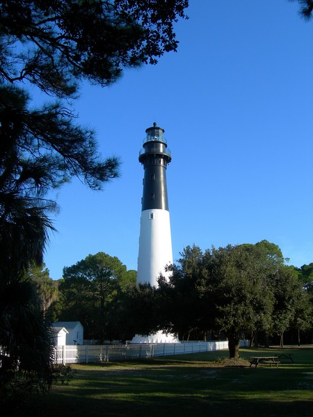 Hunting
Island Lighthouse stands tall along the preserved coastline of four
miles that fronts the Atlantic Ocean here at the 5,000 acre state
park, one of the largest in the South Carolina system. The
lighthouse was built in 1873. It replaced one that was built in
1859, but dismantled by the Confederates, to confound Union ships
offshore as they plied the shoals that mark the halfway point
between Savannah, Georgia and Charleston. It was moved to its
present location in 1889, due to erosion, and was in use until 1933.
The campground fronts the beach on the most northerly part of
Hunting Island. That wooded setting of the widespread campground is
very pretty and offers RV sites and walk-in tent sites. The
campground fills every weekend during summer and occasionally during
the week. Sites are usually available the rest of the year. Hunting
Island Lighthouse stands tall along the preserved coastline of four
miles that fronts the Atlantic Ocean here at the 5,000 acre state
park, one of the largest in the South Carolina system. The
lighthouse was built in 1873. It replaced one that was built in
1859, but dismantled by the Confederates, to confound Union ships
offshore as they plied the shoals that mark the halfway point
between Savannah, Georgia and Charleston. It was moved to its
present location in 1889, due to erosion, and was in use until 1933.
The campground fronts the beach on the most northerly part of
Hunting Island. That wooded setting of the widespread campground is
very pretty and offers RV sites and walk-in tent sites. The
campground fills every weekend during summer and occasionally during
the week. Sites are usually available the rest of the year.
|